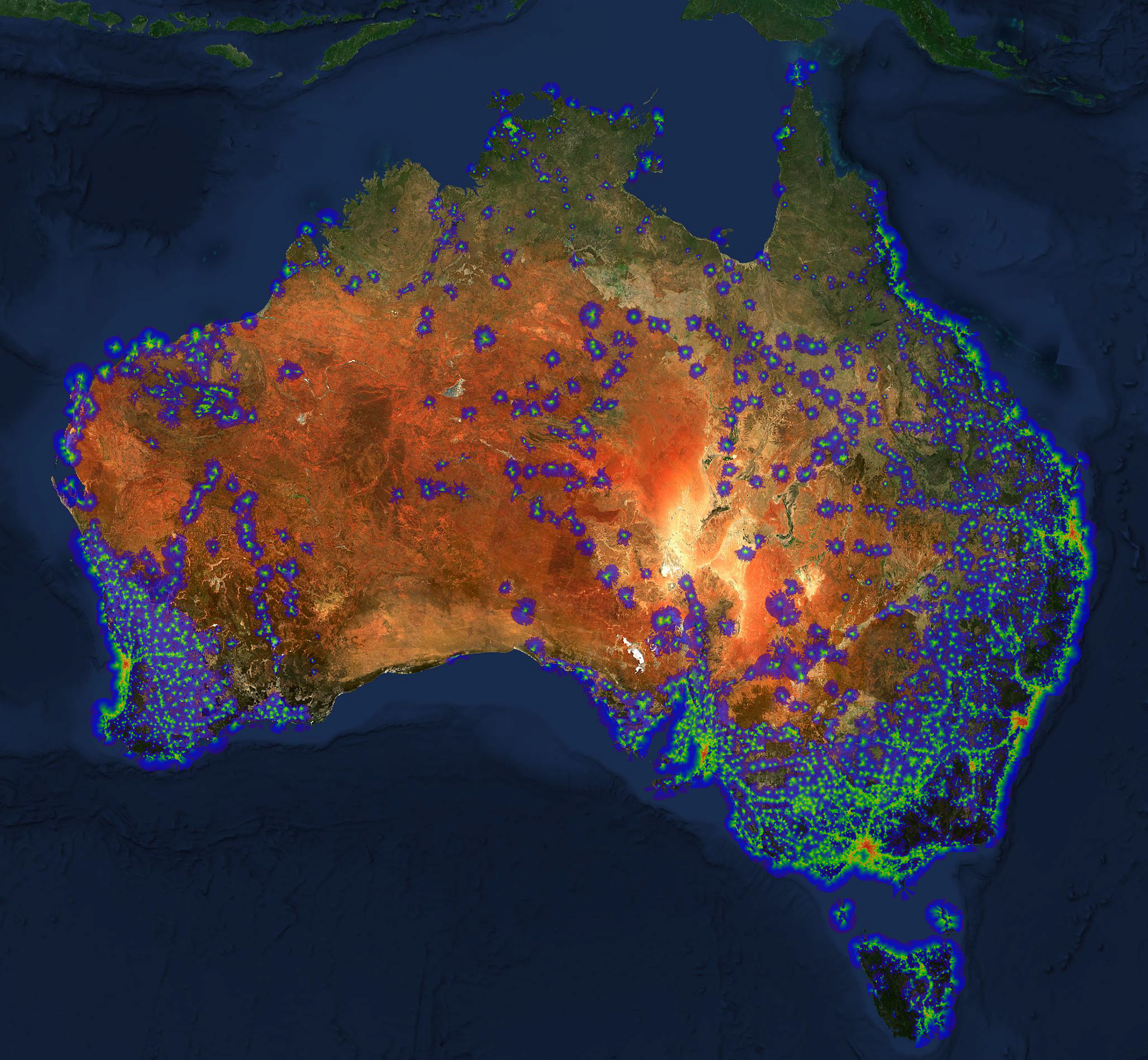
Powertec's Software Engineering Team have developed an interactive, high resolution coverage map for each mobile network operator in Australia.
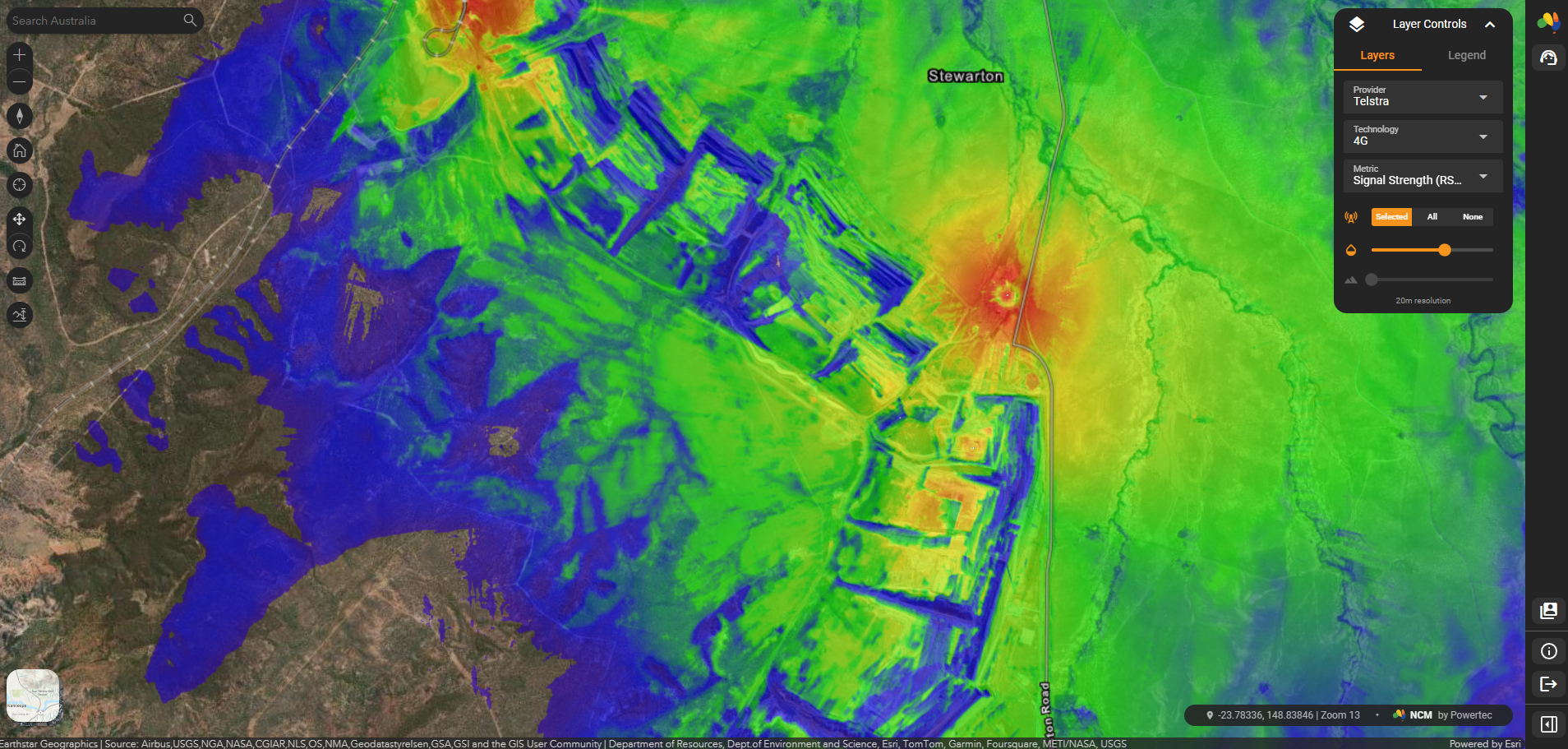
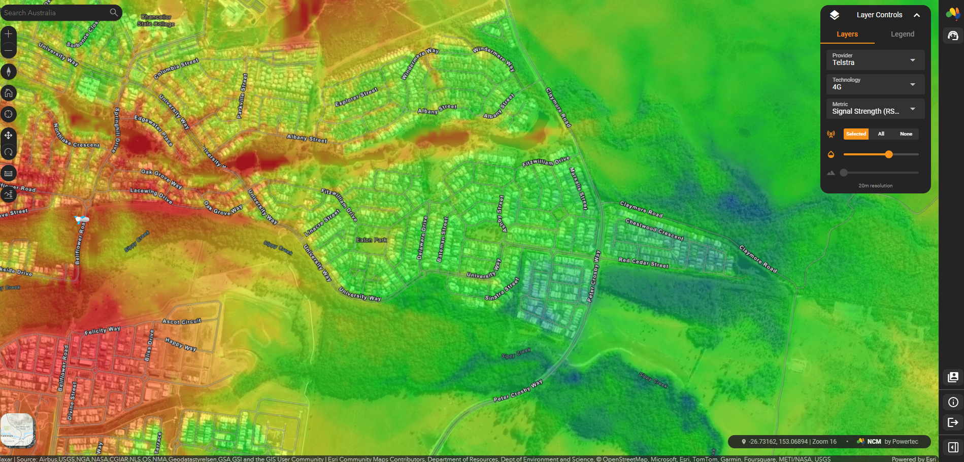
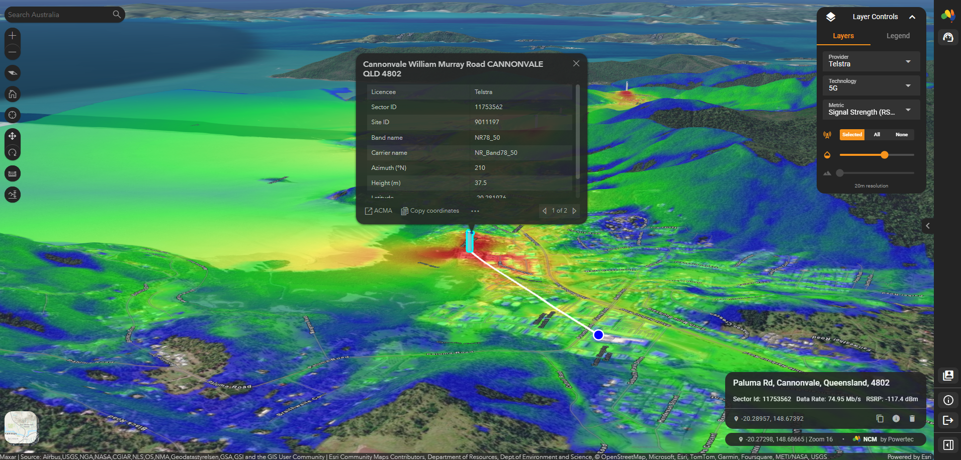
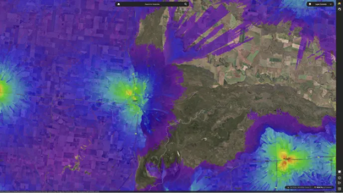
The purpose of NCM is to provide Powertec staff, dealers, contractors, and enterprise clients an online tool that can quickly estimate the performance of any mobile network at any location in the country. Accessed by your web browser, NCM provides a number of layers which can be toggled to provide a visual representation of key performance metrics of a cellular network. For example, layers are provided for Signal Strength (RSRP), Max. Data Speed (Theoretical Maximum Peak Data Rate), and Tower Coverage (Best Serving Sector).
NCM has an intuitive interface that feels similar to Google Maps, where you can search for a location with either GPS coordinates or street address. When the location is found the tool will zoom to show the location in detail. To view different performance metrics simply toggle the layers on the side of the screen. You can also click any location on the map to reveal numerical and text data associated with that location.
Purpose
NCM has been developed to provide a way for Powertec's staff and valued partners to understand the mobile network upon which connectivity technology depends. We have set out to answer "will the equipment work at this location?".
Our goal has been to represent each mobile network to the best at which publicly available information permits. Of course a lot of factors influence network performance that cannot and will never be public knowledge, for example, a tower's backhaul capacity, traffic load, etc. Of what we can know, those limitations are discussed below.
Dataset Accuracy
NCM uses a combination of datasets provided by state, federal, and private sector institutions. NCM depends on these organisations to provide accurate records of base station locations and transmitter information. Inevitably there are inaccurate data. Powertec’s software engineers have developed algorithms to clean the data as best as possible, but there are fundamental limits which are discussed further below.
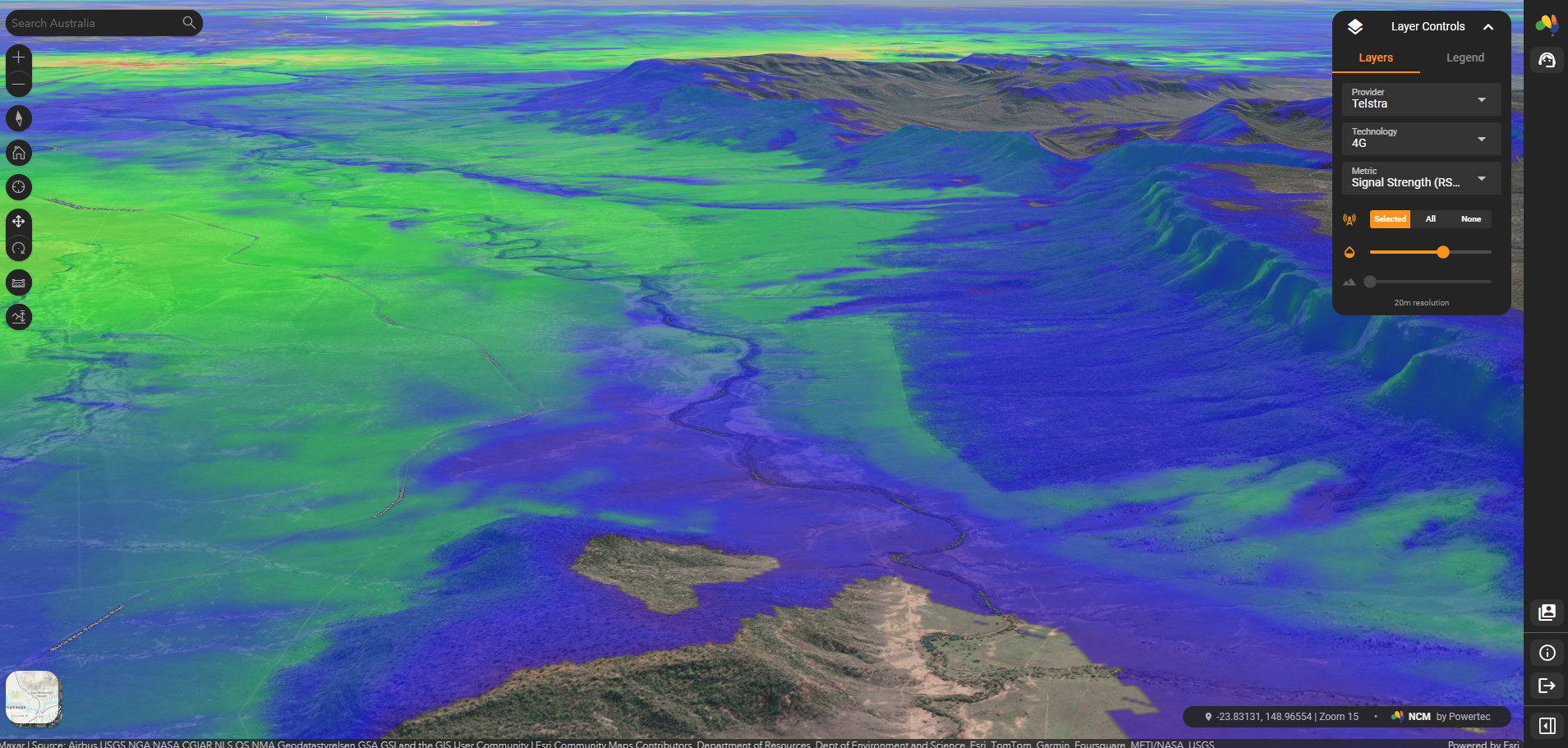
Terrain Elevation
NCM uses a stack of post-processed digital elevation models derived from SRTM (Shuttle Radar) and LiDAR (Drone) sources. These datasets capture elevation by recording a point value at set intervals and it is this interval which determines elevation accuracy. For example, remote areas of WA, SA, NT, and QLD typically rely on SRTM which has elevation captured every 30 metres. LiDAR provides extremely accurate elevation data, with data sources ranging from 50 cm to 5 metres. These data have been downsampled to a consistent resolution, excepting in the case of locations such as mine sites where pits and dumps require a higher level of accuracy.
Data recency varies by geographic location. While terrain stays constant for most of the country, the construction of roads, towns, mines, and other infrastructure creates significant changes to our natural landscape. NCM uses the most current datasets available for each region, which can vary from several years to a few weeks old. Data from populated areas is typically within two to five years.
Environmental Clutter
Trees and buildings have a major impact on mobile coverage. One of the major challenges in factoring their impact is how quickly the human and natural environments change. Weakened environmental laws have resulted in accelerated land clearing and topsoil loss in recent years. While deforestation can improve coverage, expansion of townships and residential developments can have a negative impact.
NCM uses the most recent datasets available, typically within 12 to 24 months. As automatic landcover classification relies on AI interpretation of multi-spectral satellite data the system has limitations.
As vegetation grows and buildings are built we also must factor in their height. NCM uses LiDAR and other surface model datasets to develop a 3D representation of the physical world. These data are generally downsampled to two metre accuracy, however some vector (polygonal) datasets are used to more accurately represent large buildings.
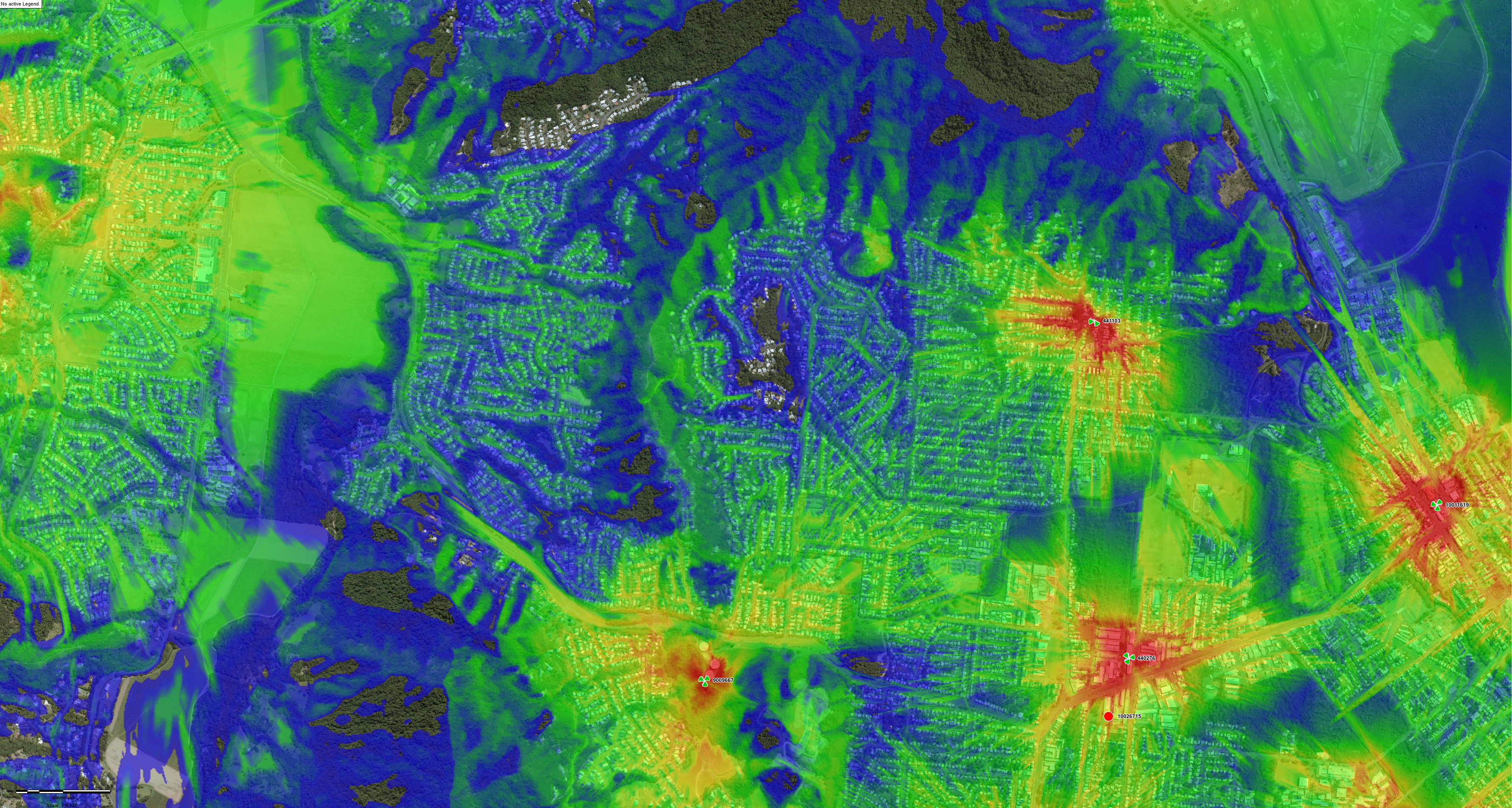
Base Station Data
All site and sector data are derived from the best available government sources. Powertec has invested significant efforts in building algorithms which check for data accuracy, automatically remove bad records, and flag suspicious records for review. Manual intervention and blacklisting is also employed to correct known inaccuracies.
But the process isn’t perfect. Telstra’s LTE network alone consists of more than 50,000 sectors across 10,000 base stations. This inevitably means inaccurate and out of date records will still be present in the system. As government record keeping continues to improve, system accuracy will improve as a result.
Population Data & Network Speed
NCM attempts to provide insight into data speed. We've thought about how best to consider the question of network traffic in order to make an estimate of a 'realistic' data speed, but there are simply too many assumptions that would have to be made. While high resolution population distribution data are used within the model, we have settled on estimating a "maximum" data speed that is a simplification based on what we can know - availability of radio carriers for carrier aggregation, channel widths, radio bearer index, etc.
This allows partners to make an educated assessment about which tower is most likely to best serve their location.
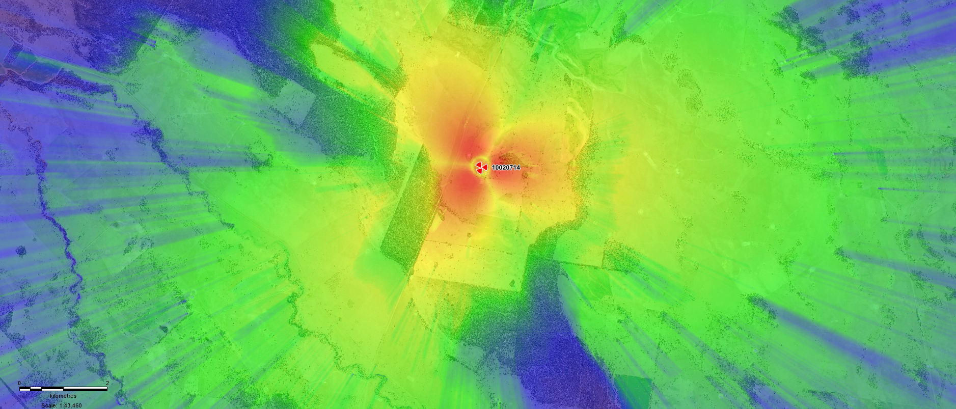
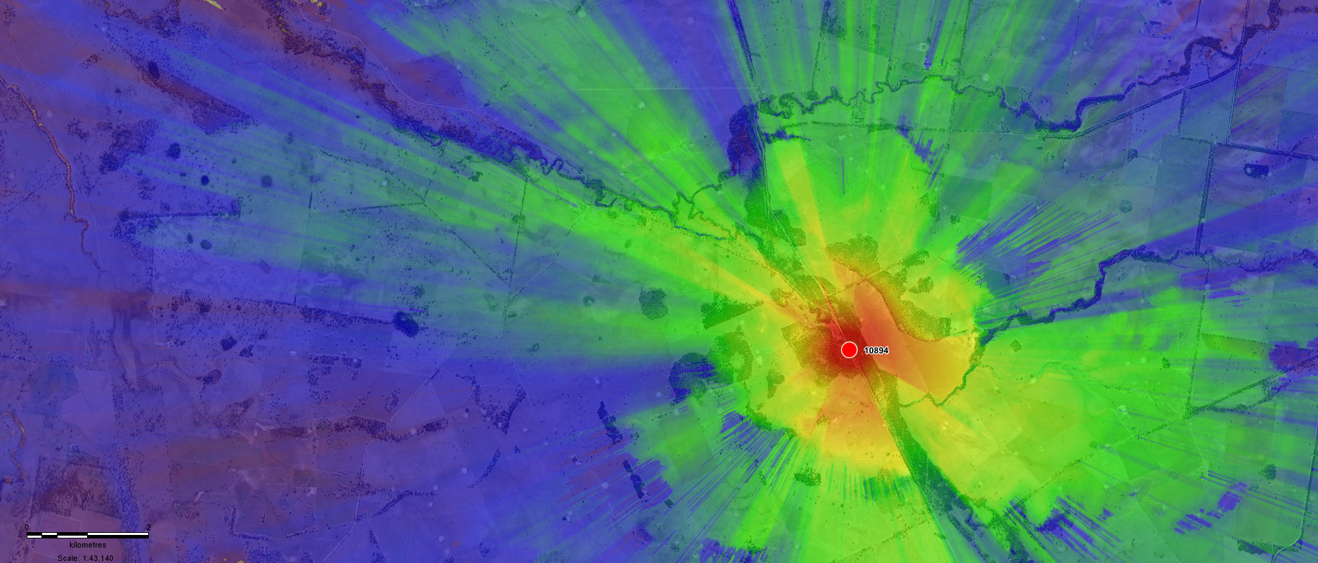
Propagation Model Accuracy
Powertec use industry leading radio propagation models are the result of decades of extensive scientific research. These models have been fine-tuned through more than ten thousand kilometres of drive-testing throughout the varied Australian environments.
For each frequency band our team aim for a Mean Error of 0 dB, and an RMS (dB) of under 4 dB for each environment type, which approaches the hard-limit that results from fast-fading of cellular signals. Presently our RMS is higher than target, at about 6 to 8 dB, however model tuning is a continual process. We expect as the system matures accuracy will continue to increase.
Drive testing has been a combined team effort, consisting primarily of myself, Fletcher Juner, and Andrei Kajalin. I would also like to personally thank Edmund Tamwoy for helping us tune our model over salt water and throughout the Torres Strait Islands.
The Team
NCM has been a personal project of mine since early 2022. After building the initial models our Software Engineering team, lead by Jackson Bowe, began the long journey of turning it into a functional GIS platform.
I would like to give a special thanks to the following Software Engineering team members, Amanda Srisourath and Adriel Nocella, for their tireless efforts on the project. I also thank the Powertec leadership team for believing in the project.
We look forward to continuing development of the project. Please feel welcome to reach out with any queries relating to the NCM and how it might help with your project.
- Doug

Doug Pukallus
I have a strong passion for wireless technologies and the way they connect the world. It is more than a career to me, and I would consider myself very fortunate if I can make a positive impact on our society or the environment that sustains us, even if only in some small way.
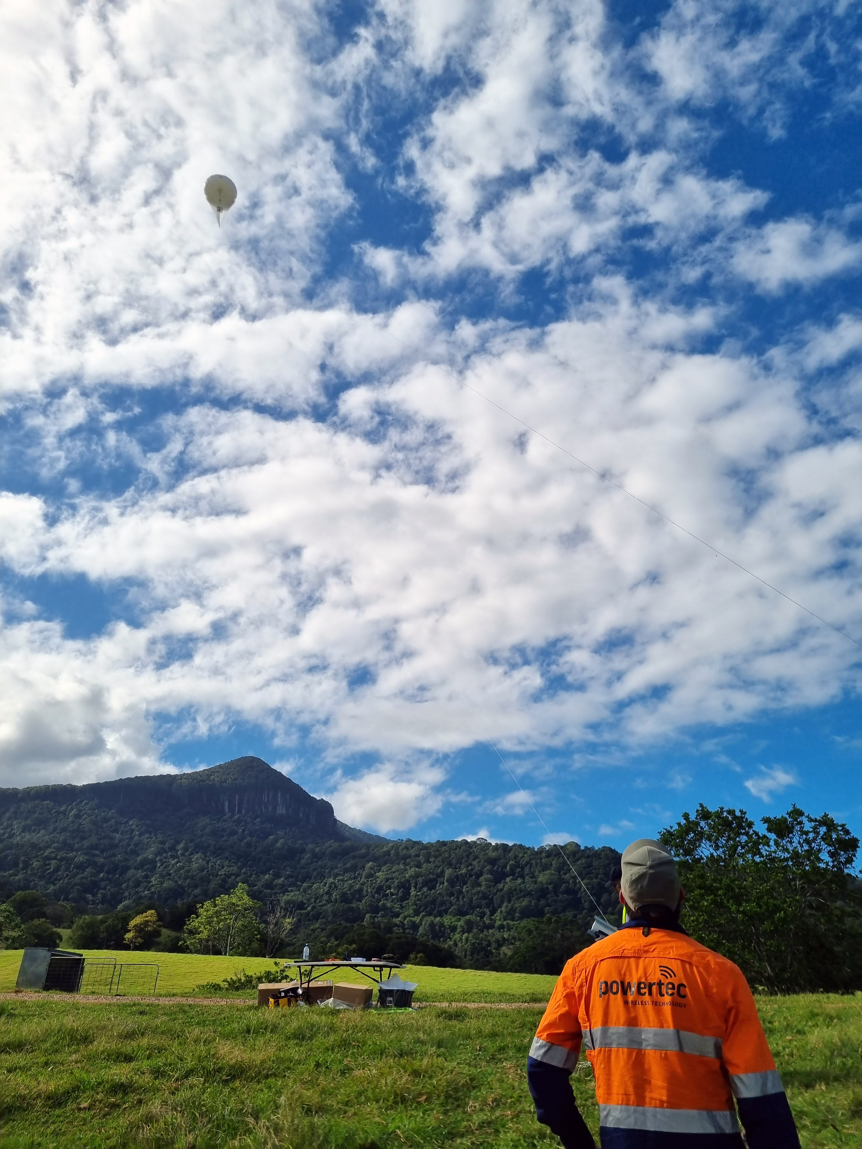
Gallery Images